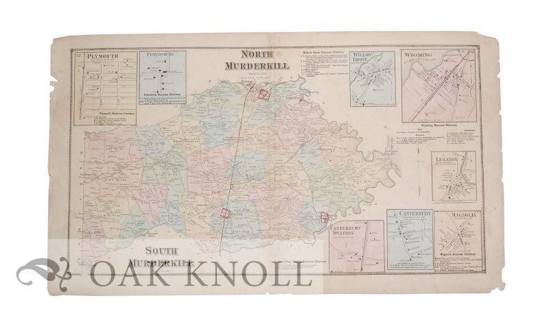
NORTH MURDERKILL, KENT CO. DEL., SOUTH MURDERKILL, KENT CO., DEL.
- Philadelphia: Pomeroy & Beers, 1868.
- 15 5/8" x 27 1/4"
- double sheet behind clear plastic mylar.
Price: $156.00 other currencies
Order Nr. 122728
B1-100. Double page map of this area of Kent Co., Delaware. Map contains a directory of businesses and small inserted maps of Plymouth, Willow Grove, Wyoming, Lebanon, Canterbury Station, Canterbury and Magnolia. Scale 1 inch to the mile. This map has been removed from a incomplete copy of Beers' 1868 Atlas of the State of Delaware (page 65), which contains "actual surveys by and under the direction of D.G. Beers." Daniel G. Beers came from a family of atlas publishers. He and his brother, Silas, operated in Philadelphia, the center of atlas publication in the United States, until 1868, when he moved to New York City. Beers and his family produced detailed maps of many Northeastern states, cities, and counties until the 1880s, when the United States began to systematize mapping practices, and mapmaking moved out of private publication (Mano, Jo Margaret). Engraved by Worley & Bracher of Philadelphia and printed by Fred Bourquin. Chipped along edges with small pieces missing not affect image.
Related Books